
The urban-rural typology is applied to the NUTS level 3 regions (subregions in Poland) and it identifies three classes of regions, namely: predominantly urban regions, intermediate regions and predominantly rural regions. This classification is based on the measurement of population density and geographical continuity (neighborhood) in cells of a grid with a resolution level of 1 km2 (a one-kilometer grid). For this purpose, the typology based on a grid with a resolution level of 1 km2, on the base of which 'urban centres', 'urban clusters' and 'rural grid cells' are determined, is used.
The three classes of units in this typology are defined as follows:
- predominantly urban regions: NUTS level 3 regions where more than 80% of the population lives in 'urban clusters';
- intermediate regions: NUTS level 3 regions where more than 50% and up to 80% of the population lives in 'urban clusters';
- predominantly rural regions: NUTS level 3 regions where at least 50% of the population lives in 'rural grid cells'.
The above-mentioned classification rules are modified for small NUTS level 3 regions and for major cities. For NUTS level 3 regions with an area of less than 500 km2, the distance between the centroid of this unit and centroids of larger neighboring units (but only within one country) is calculated to determine the unit with the nearest centroid. In the case that both of these regions have the same urban-rural class determined according to general criteria, then no change is made to the class of the smaller region. However, if these regions have different urban-rural classes determined according to general criteria, then the class is calculated for the theoretical unit being the sum of both regions. If the class of this theoretical unit is different from the initial class for the small NUTS region (with an area of less than 500 km2), then the class for the small NUTS region is adjusted to the class of this theoretical unit (the class of the second, larger region from this pair does not change). This procedure is not applicable neither to island NUTS level 3 regions nor to cases where the grouping of small NUTS level 3 regions is not possible. During the classification of NUTS level 3 regions, according to the NUTS 2016 revision, 145 small regions were reclassified on the basis of this additional criterion (out of 1348 NUTS level 3 regions in total).
In the case of large cities, a following modification is introduced:
- any NUTS level 3 region classified, according to general criteria, as 'predominantly rural' becomes 'intermediate' if it contains a city of more than 200 000 inhabitants representing at least 25% of the region’s total population;
- any NUTS level 3 region classified, according to general criteria, as 'intermediate' becomes 'predominantly urban' if it contains a city of more than 500 000 inhabitants representing at least 25% of the region’s total population.
The urban-rural typology is being updated with the results of censuses, i.e. after obtaining new data on population density in the 1 km2 grid, as well as each time after the introduction of a NUTS revision.
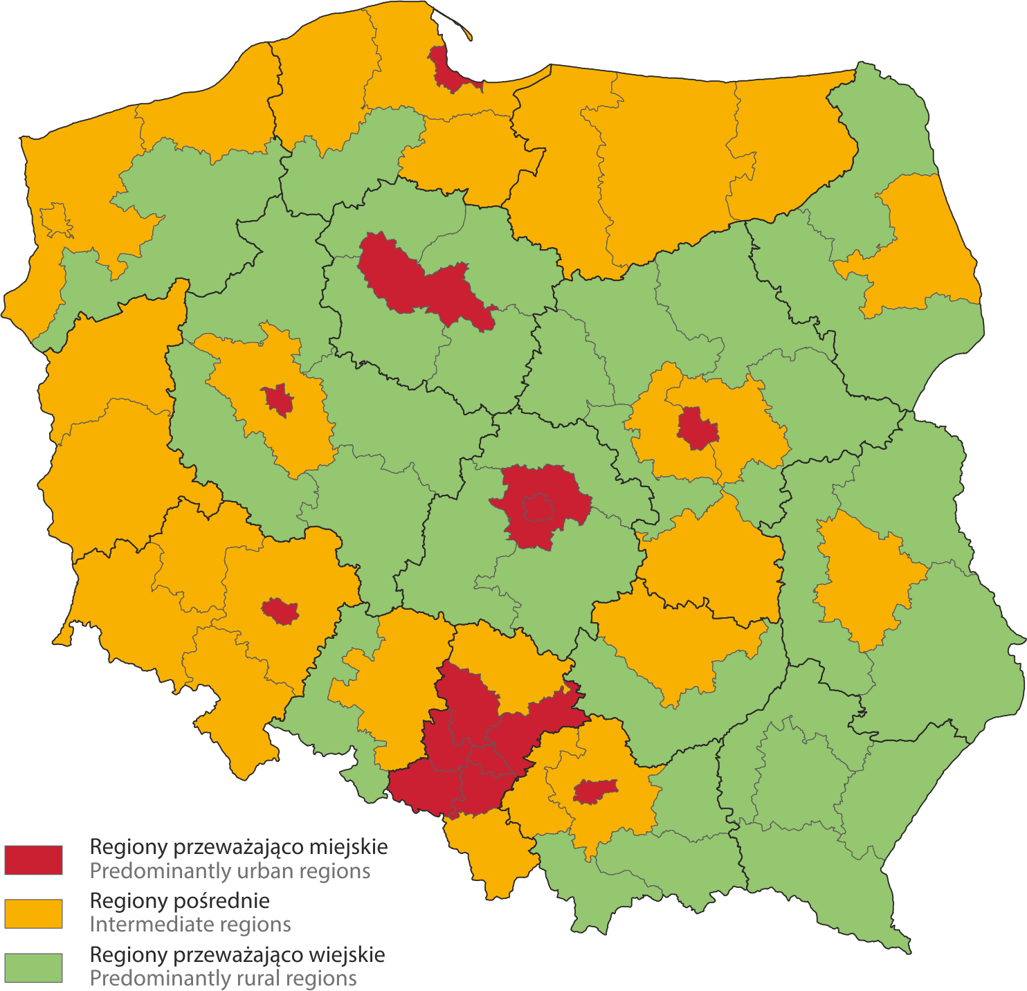
The urban-rural typology in Poland according to the NUTS 2016 revision