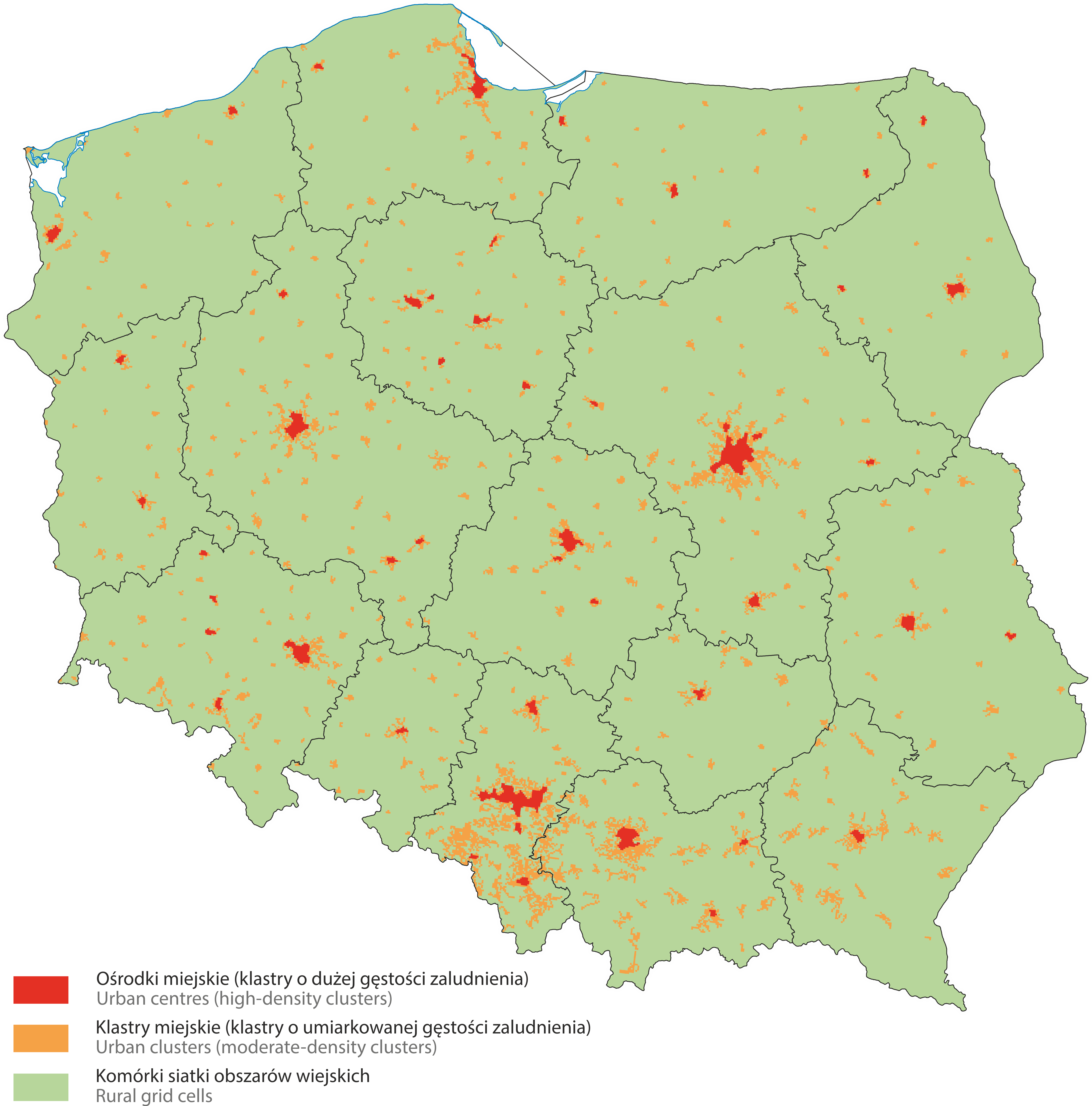
The typology based on a grid with a resolution level of 1 km2 (a one-kilometer grid, i.e. a grid with square meshes with a side of 1 km) is used to identify three types of clusters: 'urban centres', 'urban clusters', and 'rural grid cells'. This identification is based on grid cells that share similar characteristics based on a combination of their population density and geographical contiguity (neighborhood).
The three types of clusters are defined as follows:
-
urban centres (high density clusters): a cluster of contiguous 1 km2 grid cells (without diagonals) with a population density of at least 1 500 inhabitants per 1km2 and collectively a minimum population of 50 000 inhabitants; the boundaries of the urban centre thus determined are then smoothed through including all grid cells adjacent to at least five cells (including diagonals) belonging to this urban centre;
-
urban clusters (moderate density clusters): a cluster of contiguous 1 km2 grid cells (including diagonals) with a population density of at least 300 inhabitants 1 per km2 and collectively a minimum population of 5 000 inhabitants; cells classified as urban centres usually also belong to urban clusters;
-
rural grid cells (low density grid cells): grid cells that are not identified as urban centres or as urban clusters.
The typology based on the one-kilometer grid is being updated with the results of censuses, i.e. after obtaining new data on population density in the 1 km2 grid. The currently applicable typology for the territory of Poland has been determined on the basis of data from the 2021 census.
Cluster types are used as a basis for the degree of urbanisation (DEGURBA) and urban-rural typology, while indirectly they are used for determining functional urban areas and metropolitan typology.

Cluster types in Poland based on the one-kilometer grid
(Eurostat data based on 2021 population in a 1 km2 grid)

